Have you been to any Ojai hiking trails? Ojai is a beautiful city, nestled on the southern side of Los Padres National Forest. A friend told me about it and I had to go and see its beauty with my own eyes. I wasn’t disappointed at all.
It was quite the opposite; the place filled my adventurous heart with happiness. As it’s surrounded by green mountains, there are amazing hiking opportunities for everyone.
No matter your level, you can find a trail for yourself. Not to mention that all of them pass through breathtaking nature and scenery, which are hard to forget.
The tallest waterfall in the area is located there, too. After seeing it, you can continue to even more remote places through steep trails that will lift your adrenaline.
If you want to stay in nature, you can follow my example and sleep in one of the campsites there. It’s an experience that will stay with you for a long time.
So, are you ready to uncover the top Ojai hiking trails? I collected all details and in the following paragraphs, we’ll go through them together. Let’s go!
Top 12 Ojai Hiking Trails
Horn Canyon Trail
This is a trail meant for those that like to wander around different places and discover new and exciting things during their travels. As I fit in this description, I decided to try it out.
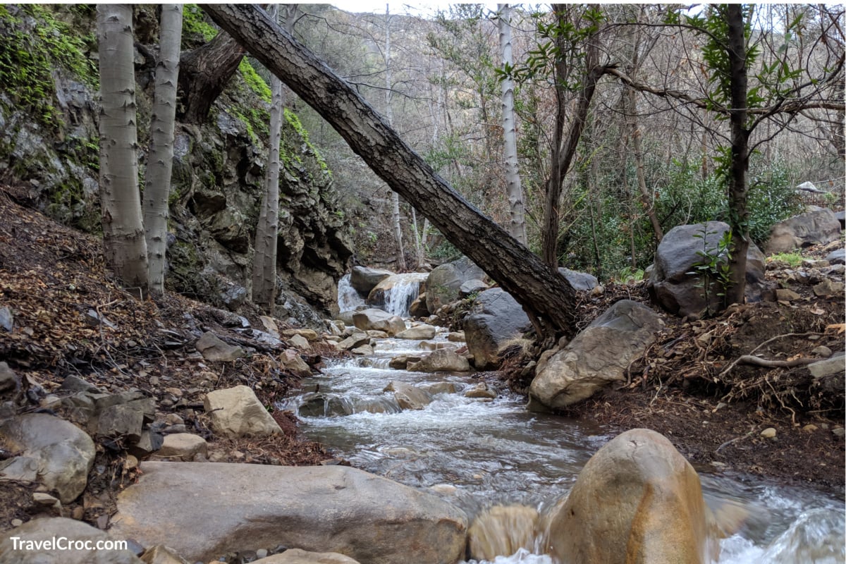
I was happy to learn that the trail wasn’t hard to locate at all. It starts near one of the private schools in Ojai called Thacher School. There is a kiosk and a sign that says ‘Horn Canyon Trail 22W08’, so you can’t miss it.
Once you climb up a mile, you’ll pass a few creeks and get amazing views of the Ojai Valley. My photo albums are full of images from this place.
Also, the trail leads to a forest that goes along the canyon. From there you have a chance to choose whether to stay in Thacher Creek where the trail passes or leave it and continue exploring the floor of the canyon. In any case, you’ll witness wonderful nature all around.
As for the time and distance, you should be aware that it takes around an hour and 45 minutes of hiking during which you can cover the distance of 2.9 miles out and back.
What’s more, the trail is open to all hikers, bikers, and even dogs. And the good news is that it’s completely free of charge. All you need is your adventurous spirit!
The exact address of the trailhead is Thacher Road & Forest Route 5N10, Ojai, CA 93023. If you’re traveling by car, have in mind that there are parking options. You can either park on the trailhead or a few miles before that.
Shelf Road Trail

This is an easy trail that you can enjoy no matter your level of expertise. I passed it without any issues and I really liked the scenic views it provides.
You can reach it by heading north from Ojai Avenue and driving on Signal Street. At the end of the road, you’ll see the start of the trail. It’s only 3.5 miles in length for a return trip and I think this isn’t much to handle at all. It took me around an hour to go to the end of the trail and back.
As the name suggests, the trail represents an abandoned road that passes by a shelf located on Ojai Valley’s north side. All around it, there are avocado and orange orchards together with wild chaparral.
Trust me, those views will stay with you for a long time even after your trip concludes. Not to mention that on every bend, you can catch a glimpse of the beautiful eastern side of the Ojai Valley.
Dogs and friendly faces will accompany you along the way for sure as the trail is open for everyone. However, the best time to visit it is between March and November when you can enjoy the lovely weather in this part of the state.
Have I increased your interest in the trail already? Then, here is its full address – Shelf Rd, Ojai, CA 93023.
Recommended Reading
- Hiking In Door County | 17 Amazing Hikes In Door County
- Hiking In San Antonio | 15 Epic San Antonio Hikes
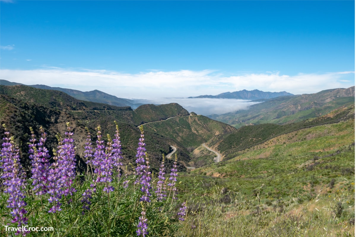
Sulphur Mountain Road Ojai Hiking Trails
Do you enjoy long hikes? If you answered yes, you’re like me. I absolutely love to let go of everything and let my mind roam free while slowly walking in lovely nature. This trail made this possible for me.
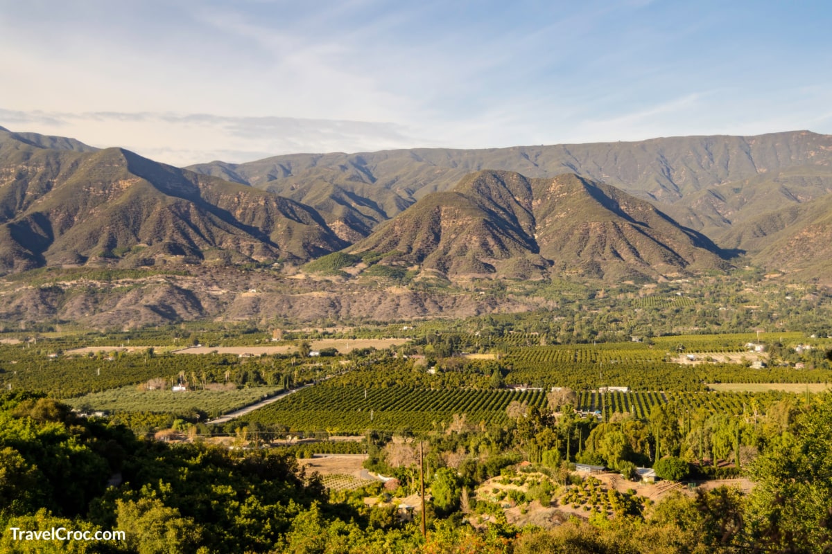
It’s considered to be relatively easy to pass. However, you should know that it’s 10 miles long and takes around three to four hours of hiking. Still, trust me, the views make the whole journey worth it. On a sunny day, you can best see the ranchlands of Black Mountain.
These lead to Oxnard and Ventura and, of course, the marvelous ocean. During the hike, keep an eye out for deer, bears, or bobcats. Wildflowers are nice companions, too.
Do you want to know how to reach it? Firstly, you should drive around 9 miles from the center of Ojai on Highway 150. Then, you’ll see a turning point for Sulphur Mountain Road on the right.
After 5 miles down that road, you should be able to see the trail. It begins at Sulphur Mountain’s end at a height of 2,600 feet. Then, it follows an old road with an elevation of around 400 feet, which isn’t too steep.
With this in mind and the fact that there is a Girl Scout Camp nearby, it’s kid-friendly, so you can organize a nice adventure for your little ones, as well.
Rose Valley Falls Trail
View this post on Instagram
Speaking of traveling with kids, the Rose Valley Falls is an easy trail that you can also try with the whole family. The nature there is simply amazing.
This is because it represents a starting point for other popular trails in the backcountry. Some of them are the Sespe River Trail, which is suitable for swimming and fishing, and Piedra Blanca that has exciting formations of white rocks and amazing gorges.
In any case, there is plenty to see and do while hiking on this trail. Basically, for most of it, you walk along a lovely stream before getting to the first cataract of 30 feet.
This enables you to enjoy the simple beauties of nature. The fact that it’s only 12 miles from Ojai makes it even more special.
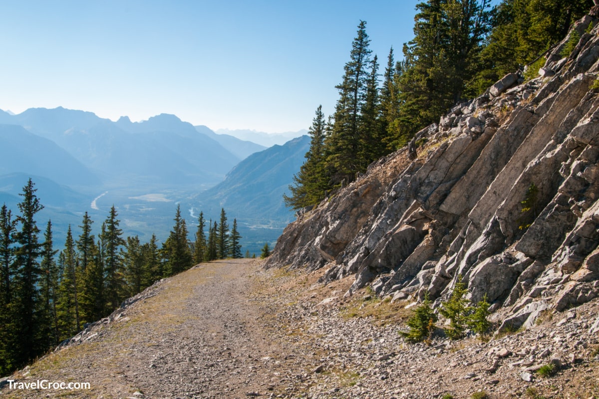
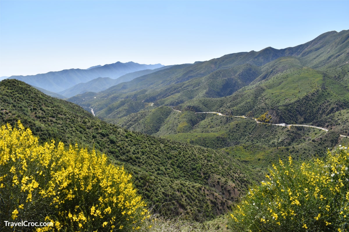
Pratt Trail
This is another beautiful trail that will allow you to explore places in Ojai you have surely never even heard of. Although, it’s considered to be moderate when it comes to its difficulty, it’s possible to pass it without any trouble.
To get to it, you should drive on Ojai Avenue and go north on Signal Street. Around 1.2 miles after that, you should spot the sign for Forest Service on the left side.
The trailhead is located about half-mile after that. And the whole length of the trail is 4.4 miles up to Nordhoff Peak. Passing through private properties, it goes around a wonderful stream with clear water.
It was a nice spot for me to splash some cold water on my face and freshen up. After this, the trail continues to a natural bowl at the Nordhoff Ridge.
After a few signs on dry roads, you should arrive at the line of the ridge. Hang on for two more miles of a dusty trail and you’ll get the well-earned prize – unforgettable views from the Nordhoff Peak, at a height of 4,426 feet.
Recommended Reading
- Hiking Near Burlington VT : 20 Top Hikes Near Burlington VT
- Hiking Trails In Northern Kentucky | Complete Kentucky Hiking Guide
Cozy Dell Trail
The Cozy Dell Trail is another trail that has moderate difficulty. This is because it starts at a creek and then quickly goes up with an elevation of 640 feet. While going up, you pass through a canyon that is rich with many wildflowers and forests, enabling you to experience some amazing sights.
These views continue on a ridge from where you can clearly see Ojai Valley in all of its magnificence. If there are no clouds, you may even spot Santa Cruz and Anacapa, located in the Channel Islands. Luckily, I had a chance to see them.
At this point, you have a choice whether to go back or keep hiking until you reach Cozy Dell Creek and a lovely place for a picnic that’s just half a mile further. There you can have a delicious meal and rest from the journey while enjoying nature.
After eating there, I continued walking a bit past the creek and found more challenging roads and trails. So, I recommend this excursion to all those that enjoy hiking and burning some calories, especially in the morning.
Are you interested in trying it out? Don’t worry as you can easily find this trail. You should simply drive north from Ojai on the Maricopa Highway.
Then, turn left by the packing house of Friend’s Ranch, and across the street, you’ll see the trailhead. This spot is nice for parking, too.
Gridley Trail
If you want to hike on a dynamic trail that passes through various places, this is the one for you. I asked my friend that lives in Ojai about it and he took me straight to it. We drove from Ojai Avenue to Gridley Road.
We stayed on it for around two miles until we reached the Hermitage Ranch‘s gates. That’s where the Gridley Trail begins. With an elevation of 1,200 feet, it gives you an opportunity to have a great adventure.
Firstly, you should climb a steep path that passes by a seasonal creek. But trust me, the effort is totally worth it as a bench with fabulous views is waiting for you at the opening. From there, you can clearly observe the whole Ojai Valley.
After this, the trail will lead you across avocado trees, orchards, and the rocky mountainside. While hiking, I often picked up soothing sounds of running water.
This is because there is a stream nearby. In fact, after you leave the mountainside behind, you’ll find yourself in the cool part of the canyon with the Gridley Springs. This is the right place to relax as there are many shades for escaping the sun.
At this point, you can either choose to go back or continue forward on the multiple trails that lead to Nordhoff Peak.
Sisar Canyon Ojai Hiking Trails
Sisar Canyon Trail is suitable for serious and well-experienced hikers. For starters, it’s among the most complex ones on the list and requires a lot of energy and hiking experience. Its length of around 10.5 miles and elevation of 4,000 feet contributes to this impression.
If you decide to visit it anyway, have in mind that you should begin in the morning as it may take you more than 7 hours of hiking. During the initial two miles, the trail passes near a wonderful stream and goes through a forest of lovely tall oak trees, sycamores, and similar.
Once you leave those behind, the trail will take you to the eastern part of the Topa Topa bluffs. In case you’re experienced and skilled enough to complete the tough climb and reach the bluffs’ top, you’ll be rewarded with magnificent views that take your breath away.
Furthermore, on a cloudless day, the sights stretch further than Sulphur Mountain, Santa Rosa, Anacapa, and even Catalina Island and the San Miguel Islands.
Recommended Reading
- El Paso Hiking Trails | 10 Amazing Trails To Explore
- Auburn Hiking Trails | 10 Cant Miss Trails ( Some With Waterfalls)
Ventura River Ojai Hiking Trails
Unlike the previous one, these trails are considered to be easy to moderate. Therefore, both people that have hiked a lot before and newbies can try them.
Yes, actually there are three trailheads that lead to the same location – Ventura River Preserve. This is a 1,600-acre land conservancy located in Ojai Valley. And I loved seeing it up close.
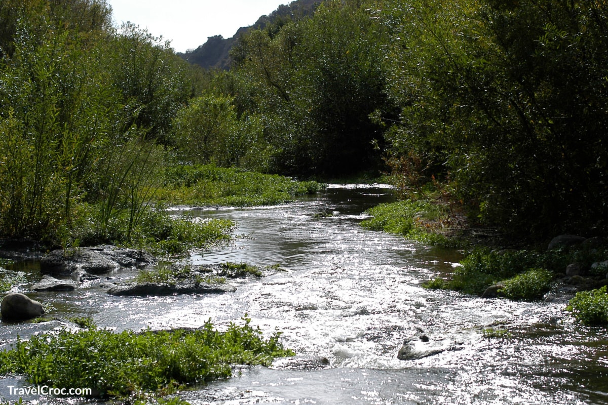
You can check out the three-mile path along Ventura River that will lead you across rocky ridgelines, grottoes, wildflowers, exciting swimming holes as well as multiple trails.
They are all amazing, especially if you pass them on the back of a horse. For those that want to play it safe, there are tours of the property that they can book. Aside from this,
I highly recommend the trailhead that begins with the Rice Road, goes across the river, climbs to Wills Creek, and then leads you to the Rice Canyon until you reach the Oso Trailhead. Visitors tend to walk it vice versa, as well. So, whatever you choose works.
You can find these trailheads if you drive on Highway 150 until you see the trailhead on the Old Baldwin Road located on the eastern side of the bridge over Ventura River.
Additionally, you’ll get to the other trailhead if you go to the intersection between South Rice Road and Lomita Road on the northern side. Finally, the Oso Trailhead is visible when you drive right on Meyer Road.
North Fork Matilija Canyon Trail

North Fork Matilija Canyon Trail is moderate in difficulty with an elevation of 316 meters. You should be aware that it’s known to have heavy traffic. It was a bit crowded when I was there, as well. But it can be handled.
One of the most exciting things about it is that it passes by a waterfall. This promises amazing views and photography opportunities. Also, there are campsites along the path for those that want to extend the adventure in nature for a longer time. I know I did.
Moreover, this is among the Ojai hiking trails that are suitable for hiking, camping, backpacking, riding horses, and even fishing. This is because there is a stream that follows you throughout the journey.
It’s a reason why you can’t really get lost on this trail. As soon as you go in line with the stream you’ll find your way. Kids and dogs are welcome to join you on the journey, too.
They’ll have a great time, especially if the weather is nice. Therefore, it’s recommended to visit it between May and November when the days are longer and the weather is more pleasant.
Did I convince you to check it out? If your answer is yes, have in mind that it’s very easy to get to it as you should only drive on Matilija Canyon Road until you reach it.
Local Ojai Hiking Trails – Ojai Valley Trail
As the name suggests, this trail is the real deal when visiting the Ojai hiking trails. Mainly, it’s because you can catch the best views of the Ojai Valley while walking on it.
A fun fact is that it’s mostly known by locals. So, it provides a quiet and pleasant hike for around 18 miles. With soothing music in my ears, I simply let my thoughts float and forgot about everything for a while. It’s definitely one of the top trails for me.
Since it’s mainly flat, you can freely bike on it while observing the wonderful nature around you. It starts from the Casitas Springs Village and passes through Ojai. That’s why it’s simple to locate. Not to mention that it can be a nice getaway for the whole family.
Recommended Reading
- Hiking Near Chattanooga | 14 Amazing Places To Explore
- Hiking Trails In Malibu | 10 Mind Blowing Hikes, Routes and Tips
Fox Canyon Trail
View this post on Instagram
We end this list with one more of the easy and relaxing Ojai hiking trails that everyone can hike on. The Fox Canyon Trail is beginner-friendly and suitable for dogs as well as humans of all ages. The only condition is to keep your furry friend on a leash while you both hike on the trail.
During the weekend, smaller crowds can gather on it but they won’t distract you on your adventure. The valley flowers were enough to steal my whole attention together with the amazing views of the valley.
Having all of this in mind, the trail is a great spot for morning hiking. In case you’re up for a more intense workout, though, this trail can be your passageway to many others in the area that are way more difficult.
A note if you come by car is that there is a long street parking that can house many cars at once, sparing you from the stress of finding a parking spot.
Conclusion
Many people wonder whether it’s worth it to go to the Ojai hiking trails. After visiting them myself, I can firmly say that they offer an unforgettable hiking experience.
No matter which ones you decide to visit, you’ll surely leave with long-lasting memories. So, happy hiking and tell us which trails you went to.