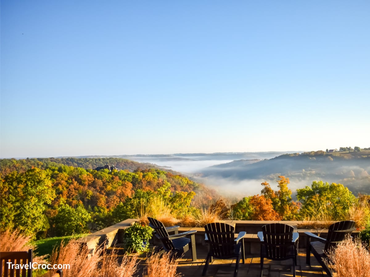
Branson, MO is known for its gambling, golfing, and mountain resort community; however, hiking in Branson MO, is also a thing. No need to be bored thinking it is all about zip lining, professional performances, and roller coasters.
The best hikes in Branson MO, will keep you entertained if you are more of an outdoors person than others in your family.
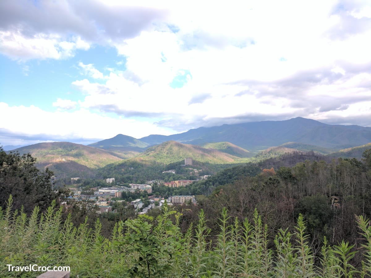
I have put together a list of 10 best hikes in and around Branson MO. This list will help you learn what you can do if you live in Branson, near Branson, or come to this part of Missouri for a visit.
Let’s Explore Hiking In Branson MO
Table Rock State Park
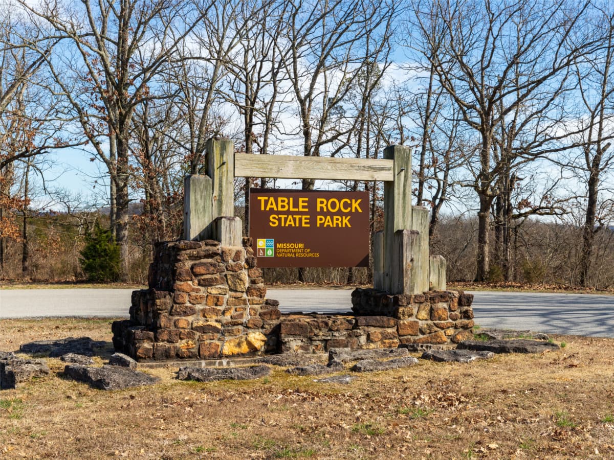
For hiking in Branson MO, you need to visit Table Rock State Park. This park sits on more than 3,000 acres of land and offers a variety of trails, which are on our top ten list.
There is also the Dewey Short Visitor Center to learn about the natural history of the area. The center also offers tours to explore the local trails with the Park Ranger.
Inside the park is beach access, hiking trails Branson MO, and picnic sites. I love that pets are welcome! You do need to keep your dogs leashed, but the main trail has pet waste stations to ensure you keep the park clean.
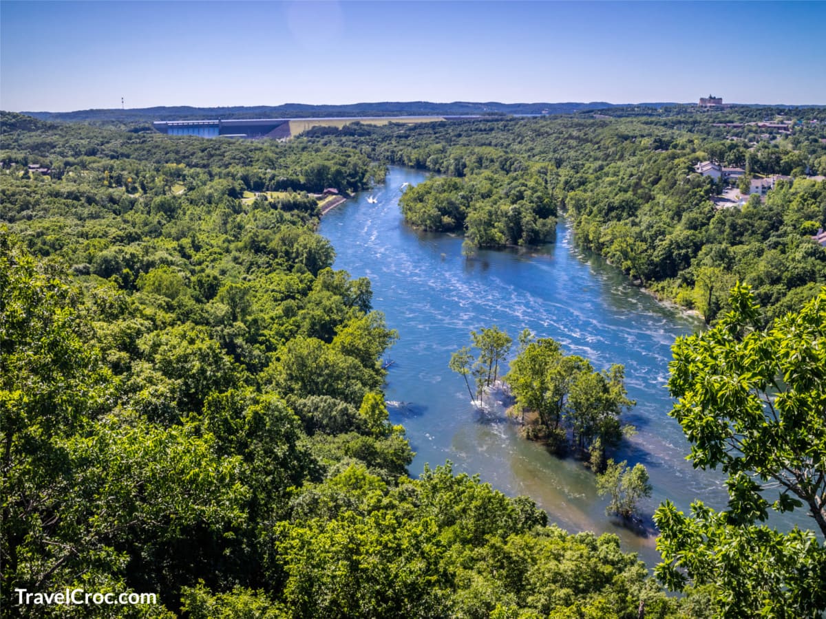
Lakeshore Trail
This trail is a 2.25-mile trail and is a very easy paved pathway for anyone wanting to take a stroll along the lake. While some trails go along the lake, other parts take you through the woods where you can see red hickory, eastern redbud, and other flora.
Some of the trees, marked with their species, are over 200 years old. Lakeshore Trail is the main course, which is an easy path that takes you along the Table Rock Lake banks. Branson is also known for its wildlife and bald eagles.
Address: 4600 MO-165, Branson, MO 65616
Chinquapin Trail
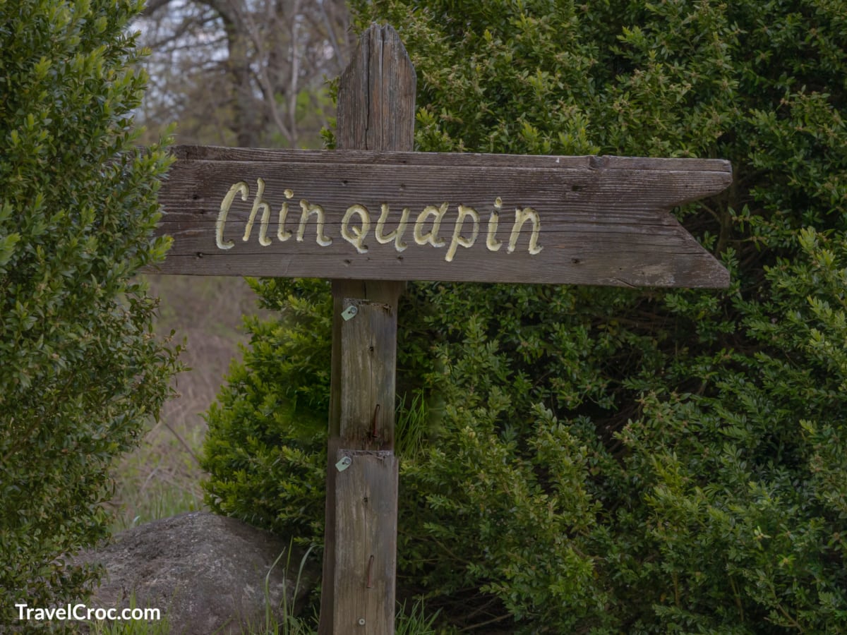
For a longer hike, you will want to go on the Chinquapin Trail. This trail is a mile long, with a natural wooded landscape surrounding the one-way path. Since the trail connects with the main course, you can enjoy over 3-miles of hiking during your visit.
Meandering through the park on Branson hiking trails, you will encounter over 11 miles of trails. Some of the trails are available for biking. You will also walk past streams, waterfalls, bluffs, and occasional rugged terrain.
White River Valley Trail System
This trail system is more for those who want a little bit more of a challenge.
This trail system is made up of four different loops:
Red Loop – This is the most challenging and has various obstacles for experienced cyclists. Along this trail, you will have an elevation change of 120 feet.
Blue Loop – This is the longest and most diverse loop. Parts of this loop are along Lake Taneycomo, then climbs to the Baird Hill glades with an elevation gain of 400ft.
Orange Loop – This loop is the shortest and it meanders to small waterfalls on the Baird Mountain Creek.
Green Loop – This loop runs through grassland, wooded areas, glade and it has amazing views. It has the highest elevation of nearly 1,200ft. Extra care should be taken on this trail, as there is loose rock, making it dangerous, and there is private property nearby.
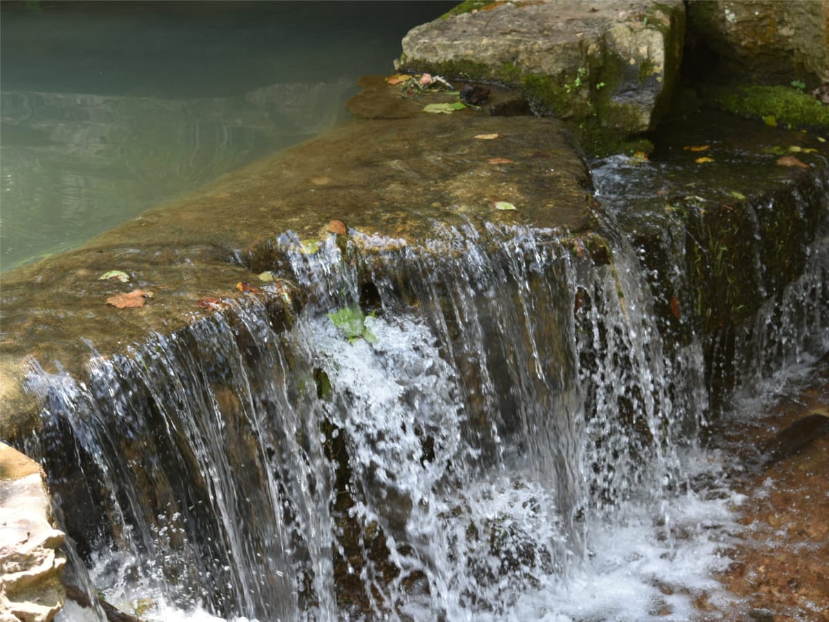
There are some beautiful waterfalls along the way, so it is definitely worth the trek.
Address: 5325 MO-165, Branson 65616
Recommended Reading
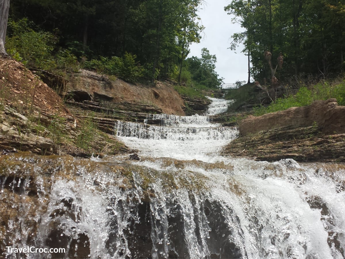
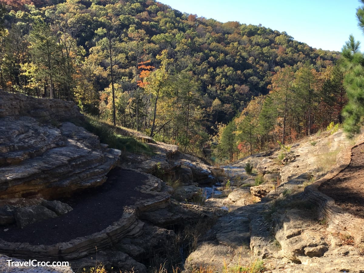
Waterfall Trail
View this post on Instagram
Since we are talking about Table Rock State Park as one giant place to enjoy numerous trails, I would highly recommend the Waterfall Trail, Branson. This trail is 2/3 of a mile long, with a variety of small waterfalls throughout the stream.
You will want proper hiking shoes to go on this trail, which runs along Roark Creek. It tends to get pretty muddy during the rainy season. To find the waterfall hiking trail Branson MO, you will need to get into the park from Westgate Resort’s entrance.
A parking lot at the Resort’s gates allows you to go on the pet and bike-friendly waterfall trail.
Address: 1902 Roark Valley Road, Branson, MO 65616
Shepherd of the Hills Fish Hatchery Trail
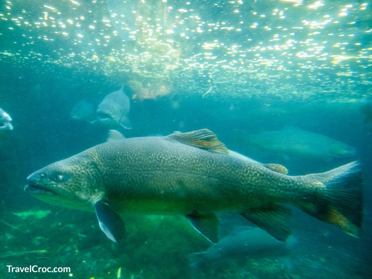
Another trail to mention in the park is Shepherd of the Hills Fish Hatchery Trail. You can access the trail by going to the fish hatchery. There is a little parking lot, where you can park and take the trailhead along the water, see rainbow trout, and even fish for them.
There are around 3-miles of trails available. It is a heavily wooded area with plenty of beauty. This trail is moderate in comparison to the lake trail.
Address: 483 Hatchery Road, Branson, MO 65616
Hiking in Branson MO In The Lakeside Wilderness Area
Once you are done in Table Rock State Park, consider checking out Lakeside Wilderness Area hiking in Branson, MO. Lakeside Wilderness Area is near the main strip and part of the Ozark’s more beautiful landscape. Lakeside Wilderness is off Highway 76.
Visitors can enjoy leisurely hikes or more strenuous trips depending on skill level. I like the 100 steps up and then the 138 steps down along one of the main trails. The shoreline trail that takes you around Lake Taneycomo has some accessible areas.
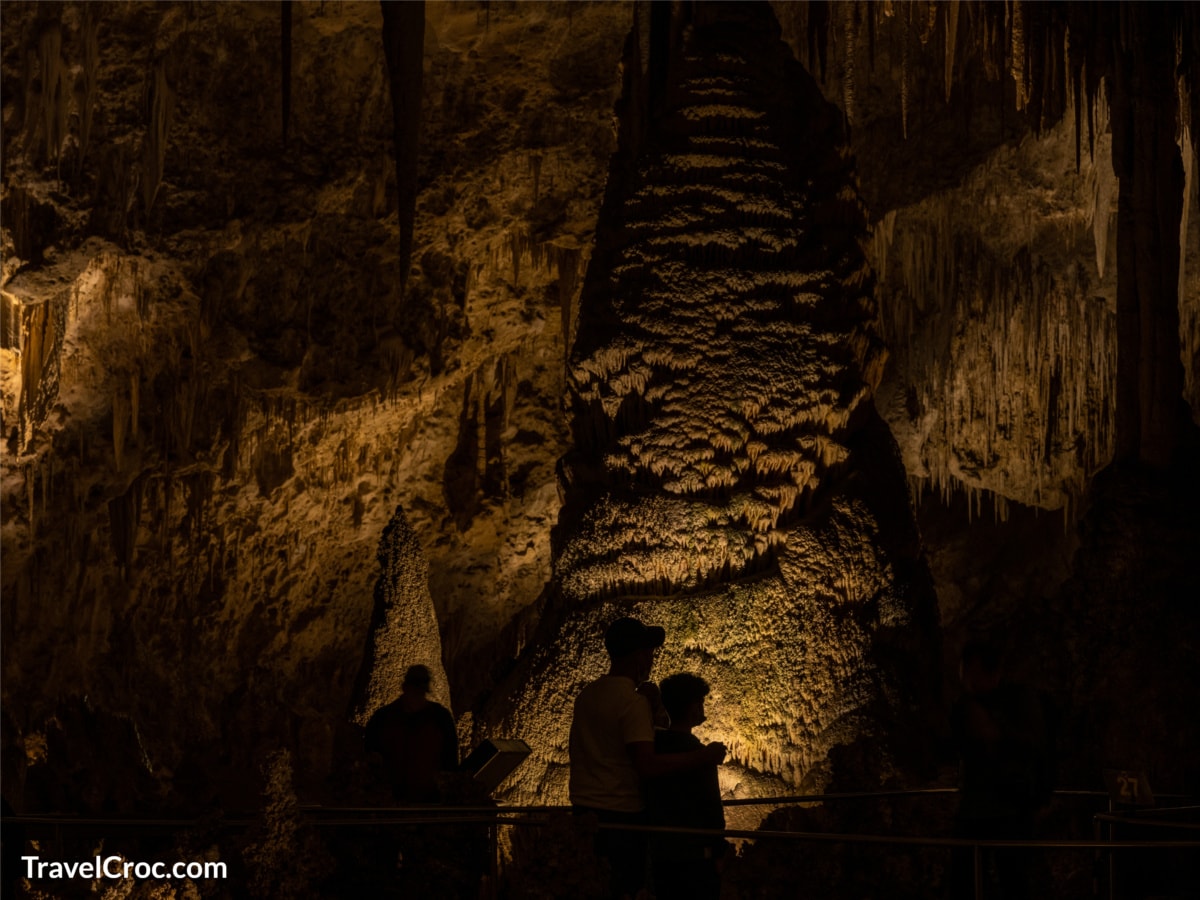
Then you can choose to go up or down to get to other sites, including those with waterfalls. There is also a cave along the trail.
Taneycomo Trail
Taneycomo Trail becomes more challenging the deeper into the wilderness area you go, so make sure you have proper hiking boots. You’ll also find Bluff Trail and Stonewall Trail in the wilderness area.
Bluff Trail
Bluff Trail is on the list of courses with waterfalls near Branson, MO. It is not a man-made trail, and the waterfall is natural. Depending on the time of year, the water may dry up, so it is best to go in spring when the weather changes and more water is flowing.
However, the view is worth the hike even if you don’t make it when the creek flows well. Bluff Trail is 1.5-miles to the cave, which makes it a moderate trail.
Stonewall Trail
Stonewall Trail has a spiraling staircase made of stone. It is best for agile hikers. Thankfully, there are benches along the stairs that make it possible to rest as you hike.
You will also come across a large oval cave at the top of the hill. Don’t forget to read the information plaque at the top that explains the cave’s history.
I like to plan for camping near Branson or a resort stay when I visit because of the numerous attributes of Lakeside Wilderness. You can also go white river kayaking, pay for a guided tour of old buildings, or just explore the trails to enjoy the waterfalls and wilderness.
Address: 412 Owen Lane, Branson, MO 65616
Recommended Reading
Hiking Near Branson MO
Ruth And Paul Henning Conservation Area
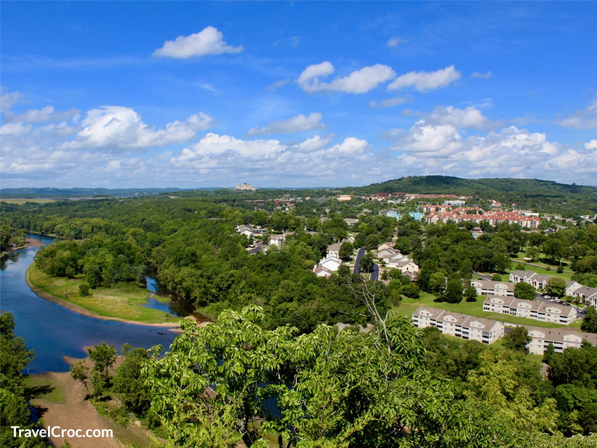
Ruth and Paul Henning Conservation Area is the third natural area on my list of hiking near Branson, MO. The conservation area is above Branson, helping you reach the Ozark glades and enjoy a 180-degree view of the city.
There is even a 40ft tall observation tower with stairs that allows you to look over the city and capture the views. The park has 1,534 acres of land with a variety of paths from easy to challenging treks.
Streamside Trail – This is one of my favorites. It’s an easy 0.4-mile loop trail. Here there’s fishing, birdwatching, and hiking to enjoy.
Glade Trail – is also an excellent trail for hiking in Branson, MO. This path is a 1.2-mile intermediate trail.
Both routes make it easy for you to get away from the city and enjoy nature for the day.
Address: Branson, MO 65616
Murder Rock Trail (Branson Creek Trail)
Located near Branson Airport and the Ozark woodlands. This trail was once extremely popular for locals, but it has become less popular with renovations in the area.
I like it because there are fewer people on the path. You may find the signs designating it as Branson Creek Trail since it also underwent a name change after the area became renovated.
Another reason this trail is on my top list is the caves, old mining trails, and the pits that were once mines. You need to walk carefully and mind the signs that tell you there is an open pit.
Stay on the trail, and don’t venture off, as it can be dangerous. ATVs are allowed, but cars and trucks are not.
Directions – Take Highway 65 South towards the airport and then turn left at Buffalo Ridge. You will see a small sign marking the trailhead. Don’t try to use GPS, as it will reroute you to a different location.
Talking Rocks Cavern Trails
Talking Rocks Cavern Trails are not only tremendous but family-friendly too. There are four trails, which are connected to make one exceptionally long hike. When you want hiking in Branson, MO, with little kids, you want to come here.
Springhouse Trail
This is the easiest hike in the area. It is 0.2 miles and takes about 15 minutes if you take your time to look around and enjoy nature.
Stone Pancakes
Next up is Stone Pancakes, a 0.4-mile trail that got its name from the rock formations. The rocks look like stacks of pancakes. As you keep going, you will come to a 40-foot-tall lookout tower that offers a magnificent view of the surrounding area.
From the tower, you can hike down to see waterfalls. Try visiting after winter when the waterfalls are flowing, as they tend to dry up in the summer months.
Address: 423 Fairy Cave Lane, Branson West, MO 65737
Recommended Reading
Dogwood Canyon
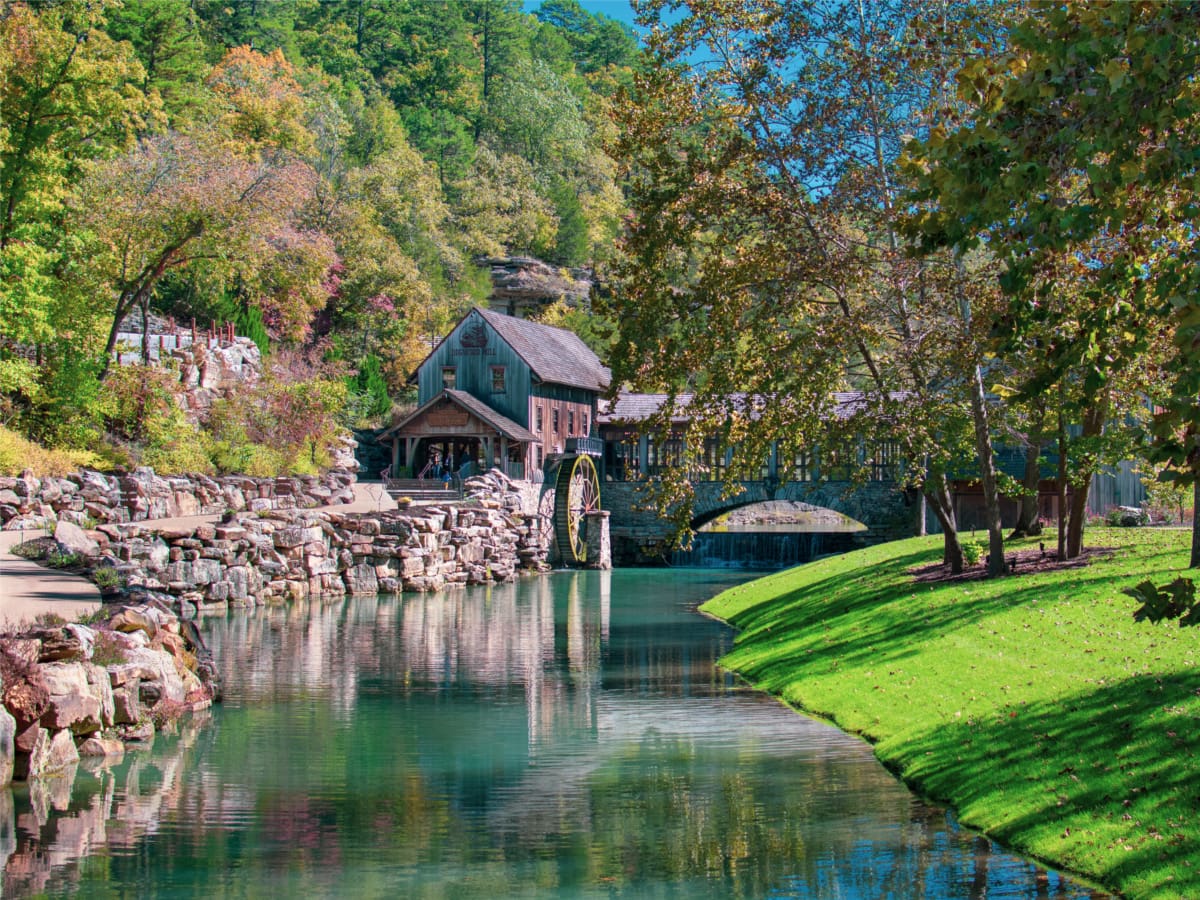
Next on the list for hiking near Branson, MO, is Dogwood Canyon. The park is 10,000 acres in size. With miles of streams, waterfalls, and trails, you will not be at a loss for something to do. The trails, including the main hike, offer ancient burial caves, bridges, bottomless pools, waterfalls, and trout fishing.
The main trail is 6.3 miles, but you should note the other end of the trail is in Arkansas, and it is not a loop trail. So, it will bring you from one end to the next, and you get to pass through two states.
Make sure people know where you are and how far you plan to hike because cell phones do not work in the wilderness area. There is also the option to take a tram around the park if you want to see more than just the main trail.
Hiking In Branson MO With A Bike
Bikes are permitted on most of the trails. You will want to bring your own food unless of course you are prepared to spend a bit at the local restaurant. It is set up for tourist prices, making it more expensive than other restaurants you can find nearby, but the food is worth it.
While at the natural area, you will want to visit some of the older buildings that were used for mining and the original settlements of the area. The best time of year to visit is spring to early summer when water is flowing in the streams, and it is less hot.
Address: 2038 State Highway 86, Lampe, MO 65681
Pet Policy: This trail is not higher on my list because dogs are not allowed, even on leash.
Opening Hours: 9am – 5pm
Entry Fees: You do need to purchase a ticket to get into the park.
Recommended Reading
Hiking in Branson MO With Waterfalls And Nearby
I have mentioned some of the waterfalls near Branson, MO because they are part of hiking trails in natural areas.
Busiek State Forest
This is another place you might want to consider visiting. There are plenty of water attractions, including waterfalls during the spring and early summer months. Just 20 minutes from downtown Branson, you have quick and easy access to a beautiful natural area protected by the state.
The forest is 2,700-acres and offers 18-miles of trails for hikers, horseback riders, and bikers. There is also a shooting range here and camping is permitted, but only if you have a permit.
Address: Highlandville, MO 65669
Hercules Glades Wilderness
View this post on Instagram
Hercules Glades Wilderness area is another well-maintained location. It is 12,413-acres of unique scenic country in the Midwest, with over 32-miles of trails, including waterfall trails. Whether you are hiking forested areas or open glades, you will see a variety of vegetation and wildlife.
From quick trails of less than a mile to spending an entire day exploring the park, you will encounter small waterfalls along creek trails. The trails do have steep terrain, so they are rated difficult, with elevation gains from 600 – 1200ft.
The best time of the year to visit is fall, winter, and spring. And camping is allowed, but you have to limit your party to no more than 10 people.
Address: Kissee Mills, MO 65680
Fisherman’s Trail
For those who love to fish, Fisherman’s Trail is the best. It is a half-mile but is also known to have the best fishing holes in the entire state.
It could just be a preference, but when you have large and small fishing holes and a bite nearly guaranteed with a few waterfalls along the trail, you don’t want to miss it.
Address: St Louis County, MO
Piney Creek Wilderness
And last on the list for hiking near Branson, the Piney Creek Wilderness area is well worth a visit. Established in 1980, it has over 8,000 acres of protected land. The forest service manages it, so make sure you go on the regulated and allowed trails.
At first, the land was owned by railroad companies. They would log the area in the 1800s, but then it was discovered by settlers who grew strawberries and tomatoes.
Eventually, Piney Creek was abandoned in the 1950s. The houses and town were no longer populated, and so 30 years later, the state decided to protect the land.
Hiking In Branson Mo And The Ozarks
The Ozarks are more rolling hills than those in higher altitudes; however, some ridgetops are 400 feet or above sea level. These ridges have water that drains into streams and lakes throughout the area, including Piney Creek, which eventually empties into Table Rock Lake.
For those interested in flora, shortleaf pine, hickory, and oak still populate the forest. You can also see ash, sycamore, elm, and walnut trees in the area.
For birds, herons and woodpeckers tend to frequent the area. You can find a trail map online at the US Department of Agriculture. With so many acres and trails, you want to make sure you are going around the area safely.
The east-west route takes you 4 miles through Piney Creek and along the actual creek. Pineview Tower Trailhead to the north connects to the south Piney Creek trail in about 1.5 miles. Two other trails are great for those who want to hike or ride horses.
The entire area has 13.1 miles of trails. There are plenty hiking trails to keep you busy when you visit this area, whether it is for a week or several weekends.
You will find most trails are at a moderate level and best completed in winter, spring, and fall. Summer tends to be too hot.
What To Look Out For When Hiking In Branson MO
Stay on the marked trails to avoid getting lost, encountering poisonous plants, and listen for snakes when walking on the trails. Copperheads, pygmy rattlers, and timber rattlers are known in the area, all dangerous to humans.
You should also know there is no camping without a permit, and even then, you need to be 100 feet off the trails in the correct areas.
Pet Policy: You should be aware that dogs are not allowed.
Address: Shell Knob, MO 65747
Recommended Reading
Final Notes On Hiking In Branson MO
Hiking in Branson, MO, is diverse, with a multitude of trails of varying lengths from short, easy day hikes to more strenuous treks along 6 miles of track. Whether you visit the area once or you live nearby, you will always have outdoor activities.
Wildlife does live in the area, including bears, deer, and small animals. Many of the trails are great for birdwatching, horseback riding, or fishing.
Make sure you know which trails require a permit and which are free to use. Just enjoy your time! And Let us know if you’ve done any hiking in Branson, MO.
If you have a trip coming up or want to getaway for the weekend be sure to check out our site TravelCroc.com.